"The “Indian Land Areas Judicially Established 1978” map was prepared by the United States Geological Survey at a scale of 1:4,000,000, Albers projection from information provided by the Indian Claims Commission. The map portrays the results of cases before the commission in which an Indian tribe proved its original tribal occupancy of a tract within the continental United States. Each tract is outlined with a solid black line. The number on each tract refers to the Indian Land Area Map Index in the commission’s final report. A dashed line around an area indicates that the case was settled before an exact area was defined. Adjacent tracts with the same color indicate a tribal relationship. Otherwise, the coloring is arbitrary.
The map was reissued by the United States Geological Survey in 1993. This map was digitized by the Center for Advanced Spatial Technologies to a scale of 1:5845860 using a Lambert Azimuthal Equal Area Projection. State, and county data were then added. Although better resolution can be gained by viewing a the PDF version, users are urged to use the Native American Consultation Database to search for specific information." -National NAGPRA
Ohio*
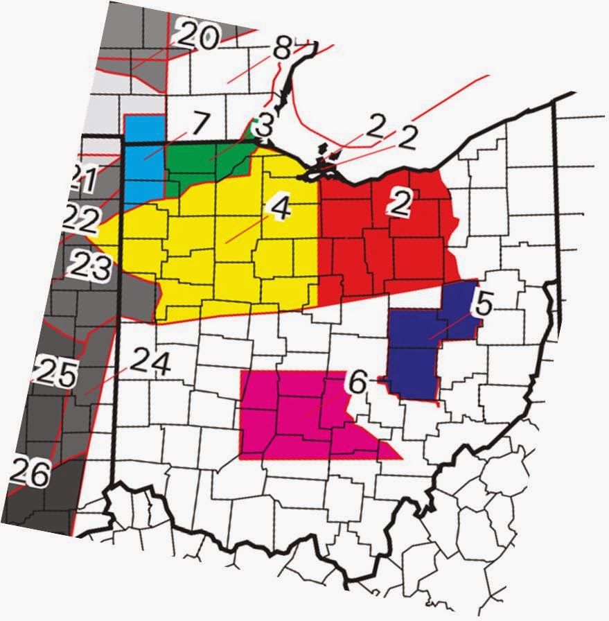 |
| Ohio Close-up from the map "Indian Land Areas Judicially Established 1978". |
2. Delaware, Wyandot, Potawatomi, Ottawa, Chippewa
3. Ottawa
4. Delaware, Ottawa, Shawnee, Wyandot
5. Delaware
6. Shawnee
7. Potawatomi, Ottawa, Chippewa
23. Miami
*Numbers are according to the Map Index here.
No comments:
Post a Comment